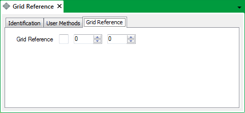
The Grid Reference Parameter Form includes a Grid Reference tab.
Use the Grid Reference fields on the tab to specify the Ordnance Survey® map grid reference. (The Ordnance Survey is Great Britain’s national mapping agency.)

The Grid Reference consists of three components:
- Use the left-hand field to specify the Ordnance Survey (OS) sheet reference.
- Use the center field to specify the Eastings (the distance east from the sheet reference’s origin, in kilometers).
- Use the right-hand field to specify the Northings (the distance north from the sheet reference’s origin, in kilometers).
Example:
The Landranger series of maps are divided into 100km squares.
The OS Grid Reference for the town of Coventry, England is SP 335 785, where:
- SP is the identifier of the 100km square that includes Coventry.
- 335 is the Eastings (taken from the numbers that run from west to east across the map). In this example, the reference indicates that the center of Coventry is 33.5km east of the SP square’s origin.
- 785 is the Northings (taken from the numbers that run from south to north up the side of the map). In this example, the reference indicates that the center of Coventry is 78.5km north of the SP square’s origin.