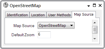
To configure a Map Source you use the Map Source tab of a Map Source form (see Configuring a Map Source).
This section describes the OpenStreetMap® (OSM) Map Source.
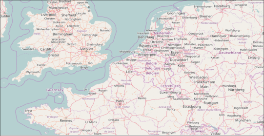
OpenStreetMap is a global mapping project that creates and distributes a free editable map of the world. It is built by a community of volunteer mappers who use aerial imagery, GPS devices and field maps to verify the accuracy of OSM data. OSM also makes use of openly-licenced data from national mapping agencies, such as the Ordnance Survey® in the UK.
OpenStreetMap asserts the following caveat concerning the support and accuracy of OSM data: "Please bear in mind that we are unable to offer any kind of support or stability. If that is something that you'd be interested in, then please investigate using one of the other providers listed in the 'Alternative OpenStreetMap Tile Providers' section or listed on this page:
http://wiki.openstreetmap.org/wiki/Commercial_OSM_Software_and_Services"

- Map Source—Use this combo box to enter the type of this Map Source. In this case, you would select the OpenStreetMap option to configure the OpenStreetMap base layer:

- Default Zoom—Define the default zoom level for the OpenStreetMap base layer map.
The Default Zoom level is the magnification level that Geo SCADA Expert will apply to a map layer when it first displays it. Users can then use manual controls to either zoom in or zoom out from this default level (that is, they can increase the magnification or decrease it). For more information, see Using a Geo SCADA Expert Map. If you increase the Default Zoom level, users will be able to see the map layer's features in greater detail. If you decrease the Default Zoom level, users will see less detail. The lowest zoom level is 0; this represents the lowest magnification level. The highest zoom level is 22; this represents the highest magnification level.