You can associate any item in the database with geographic coordinates. This enables you to display the location of a database item on a ClearSCADA map (see Displaying the Geographic Location of a Database Item). This is also useful for tracking the location of mobile assets and staff in relation to their geographic location. For example, ClearSCADA can monitor the current location of maintenance engineers to determine which one is nearest—and therefore might be best placed—to respond to an alarm condition at a particular remote site. Similarly, ClearSCADA can monitor the proximity of WebX clients in relation to a particular geographic region and automatically filter the alarm data on those clients to just alarms that relate to database items within that geographic region. With this latter setup, as the WebX client is transported from one region to another, the alarm filter changes automatically to show the alarm data for the appropriate geographic region (see Define the User Location Sources and see Filter Alarms by Region).
The Location Tab
Every item in the database has a Location Tab that you can use to specify an item's geographic location.

The Source combo box allows you to select one of the following options to define the geographic location of the item in different situations:
This is the default option for all items within the database. When you select this option the item inherits the location coordinates from the parent Group or the System group. This allows you to group a set of items that share a single location within a group, for example, an outstation and associated points.
You should only set a User's Location Source to 'Inherited' if that user is expected to be static (based at a particular site, rather than move from one site to another). This is because ClearSCADA's Geographic Location features will then use the coordinates of the Group in which that User is placed in the database to determine the User's geographical location.
Use this option to enter the coordinates of a database item that is in a fixed location. For example, an outstation. When you select this option, ClearSCADA displays the Position field.

Specify the Latitude and Longitude of the database item (in degrees) as a comma-separated string. Optionally, you can add an Altitude (in meters above sea level) (see Accuracy and Altitude) to the string.
Example:
You would enter the DMS geographic position of:
40° 26' 46" N 79° 58' 56" W
as
40.44611111111111, -79.98222222222222
All numeric location / region coordinates in location strings use the English decimal point (a dot).
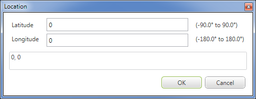
You can also enter the coordinates by selecting the browse button to the right of the Position field. If you do this, ClearSCADA will display the Location dialog.

You can now enter the Latitude and Longitude of the asset's geographic position in the appropriate fields (you cannot enter the Accuracy and Altitude in this dialog).
Coordinates can be entered in localized decimal format (for example, 40,44611111111111), but they are converted and stored by ClearSCADA in the English decimal form.
Example:
You would enter the geographic position of 52.4777°N, 1.8988°W as:
Latitude: 52.4777
Longitude: -1.8988 (West is negative)
NOTE: You can also specify the Static coordinates programmatically. For more information, see Expressions.expr-primary-location.
Use this option for mobile assets and users that are expected to move between sites. For example, you might specify that each User's geographic coordinates are dynamic (that is, they can change), so that you can track the current location of those users and / or filter alarm data according to each user's proximity to a particular geographic region (see Define the User Location Sources and see Filter Alarms by Region).
Use this option if you do not want to enter a geographic location for the database item.
The item will not inherit the geographic position from its parent database item. If this item is a Group, nor will anything within this Group item have a geographic position (with the exception of any 'child' items that themselves have their Location Source set to 'Static' and Position coordinates specified).
ClearSCADA uses an item's coordinates to perform geographic location related activities, such as indicating the item's position on maps. ClearSCADA can record the following location information if the item includes the data:
- Longitude and Latitude
- Accuracy (in meters)
- Altitude (in meters)
- Altitude accuracy (in meters)
- Heading (in degrees clockwise from North)
- Speed (meters per second)
- Timestamp (yyyy-MM-dd [HH:mm:ss.SSS])
You can also access an item's coordinates from other displays, such as the item's Status display (where you can view the coordinates in the form of a Position status attribute).