Associate Regions with a Map Set
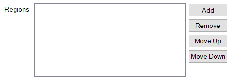
Use the Regions field on the Map Set tab of a Map Set Form to define which Regions are associated with a Map Set. For more information about Map Sets, see Creating a Map Set and see Configuring a Map Set.
You can do the following:
- Add a Region to a Map Set
- Delete a Region from a Map Set
- Move the order of a Region's entry in a Map Set. This enables you to control the order in which the Regions appear in the map's Layer menu and get overlaid on the map (see Using a Geo SCADA Expert Map).
The Regions field shows the Regions in a Map Set. You can populate the field in order to associate specific Polygon Regions with a Map Set and display those regions on a map. (If you include other shaped Regions in the Regions field, they will not appear in the map's Layer menu or on the map.)

The Regions field includes four buttons, Add, Remove, Move Up and Move Down, which enable you to manage the Regions in the Map Set.
Use the Add button to display a Reference browse window from which you can select a Region to include in the Map Set.
The order in which Regions are listed in the Regions field determines the order in which those Regions appear in the Layer menu when you display the Map Set, and the order in which those Regions are overlaid on the Map. You can use the Move Up and Move Down buttons next to the Regions field to change the order of the entries.
To remove an unwanted Region from the Regions field, select the required entry followed by the Remove button.
Once you have created the Map Set, users can display it as a composite map (see Displaying a Geo SCADA Expert Map). The map has a Layer menu that shows the Map Sources (layers) and Regions in the Map Set and enables users to choose which layers and Regions to view (see Using a Geo SCADA Expert Map).
Due to the nature of projecting the globe onto a 2D map, the lines drawn to represent a Polygon Region are an approximation. The closer to the pole and the longer any given line (that is not exactly orientated north-south), the greater the degree of inaccuracy.
Further Information